GRAHAM COUNTY • NORTH CAROLINA
Unspoiled natural beauty around every curve.

Eastern Band of Cherokee Indians
The Indians of Graham County known locally as the Snowbird Indians are heirs of a great and powerful Cherokee Indian nation that existed in the Southern Appalachian Region long before the white settlers moved into the mountains.
Early records show that the few early white settlers lived harmoniously with the Cherokee in Graham County until the Indian Removal act of 1830 which forced relocation of the Cherokee out of their mountain lands to Oklahoma. The forced relocation is also known as the “Trail of Tears” because of its devastating effects. Tatham Gap Road was constructed by the army for the purpose of Cherokee removal and today is designated as part of the Trail of Tears. Not all of the Cherokee in Graham County were caught up in removal. Many escaped into the secluded mountains of Snowbird, Buffalo, and Santeetlah.
Chief Junaluska
The most prominent leader of the Cherokee in Graham County was Chief Junaluska, known for saving the life of Major General Andrew Jackson during the Battle of Horseshoe Bend. Jackson later became President where he signed the Indian Removal Act. It was reported that Jackson met with Junaluska regarding the Indian Removal Act telling Junaluska that there was nothing he could do. Junaluska joined his people in the removal to Oklahoma and later returned, walking the entire route back to Graham County. Junaluska died October 20, 1868 and was buried in Robbinsville. His grave was originally marked, in traditional Cherokee style, with a pile of stones, but in 1910 the Daughters of the American Revolution erected a monument at his grave site. Today a memorial stands in his honor at this location in the Town of Robbinsville.


Graham County Logging & Railroad History
Graham County in its early days was heavily forested. The dense undergrowth and rough terrain coupled with complete lack of transportation facilities caused this area to be one of the last in the state to attract industries with the exception of logging.
White pine, yellow poplar, chestnut, basswood, and cherry were logged were either floated down the streams and rivers or hauled in carts by teams of oxen. River drives were started in the 1880's. Logs were transported by horse or ox to splash dams on West Buffalo, Little Snowbird, and Big Santeetlah Creeks and then floated down the Cheoah River to the Little Tennessee River and then to a sorting boom in Tennessee. Men followed the logs in whaleboats and freed lodged or breached logs with pike poles and peavies.
River driving gave way to railroad transportation in the 1920's. Lumber that was produced on small circle mills was hauled on wagons either to the Southern Railroad which ran along the Little Tennessee to Calderwood or Graham County Railroad Company for transportation on to Andrews or Canton. The Buffalo Snowbird Railroad Company constructed tracks for transporting lumber in western Graham County to Robbinsville. Eventually logging trucks replaced the railroads in the late 1940's.


History of Hooper Bald Hunting Lodge
In 1908 Whiting Manufacturing, an English company, purchased most of the land in western Graham County, including Hooper Bald. The land was to be logged and the company agreed to lease Canadian Business man George Moore 1600 acres to establish a European style hunting preserve near Hooper Bald for the entertainment of wealthy clients and friends. An elaborate lodge, caretakers cabin, and fenced game lot were constructed in this remote area.
The Lodge was 90 feet long and 40 feet wide, constructed of logs. It contained 10 bedrooms, two baths, a kitchen, and dining room. The caretaker's cabin was a four-room cabin with a porch all the way around. A local, Cotton McGuire, was hired as caretaker of the preserve. Surrounding the lodge and caretaker’s home, huge enclosures for the animals were constructed. There was even a telephone line strung 10 miles up the desolate mountains from Marble, NC to the lodge.
In 1912 the various game animals started to arrive at Hooper Bald. These included eight buffalo, fourteen young wild boar, fourteen elk, six Colorado mule deer, and thirty-four bears nine of which were huge Russian brown bears. Two hundred wild turkeys and ten thousand English ring-necked pheasant eggs were brought in. Additional turkeys were purchased by Moore and scattered about the mountain in an effort to get them started. Finally all constituents of a modern sportsman's ark were present on the Bald.
However, the location proved to be too remote for the genteel Englishmen or anyone else and Moore himself soon became disenchanted with the Hooper Bald project. The venture was ill fated and by the mid 1920's only Cotton McGuire, keeper of the preserve, remained on the mountain. Following the final departure of Moore, McGuire was given the lease for the lodge and caretaker’s house.
Nothing remains of the Lodge or Caretaker's Cabin which is now on private property. Hooper Bald is part of the Nantahala National Forest at mile marker 8 on the North Carolina side of the Cherohala Skyway. The Trailhead pull off is well marked and has a parking lot and picnic tables. You'll find a 1.2 mile trail to the open grassy area with incredible views, the hike is good for all skill levels.
Joyce Kilmer Memorial Forest
In the late 1880s, the rivers in western North Carolina were used to transport logs. Splash dams were built and logs were floated down the Cheoah River to the Little Tennessee River and eventually into Tennessee. Logging companies owned much of the lands in the western part of the county including the virgin track in the Little Santeetlah Creek basin. This tract was remote and surrounded by difficult terrain. The lumber companies decided not to cut the timber. In 1924 the Gennett Lumber Company acquired land which included this virgin forest.
In the 1920s harvesting the virgin forest was even more difficult because of the reservoirs created by Cheoah Dam and Santeetlah Dam. The reservoirs swallowed the rivers and railroads used to transport the logs. In addition, the Great Depression brought down the price of lumber so the virgin forest remained untouched.
In 1934 a New York chapter of the Veterans of Foreign Wars petitioned the federal government for a memorial to Alfred Joyce Kilmer, an American soldier killed during World War I. Kilmer was a popular poet and had written a poem entitled, “Trees”. It was decided that an appropriate memorial for the poet would be a tract of virgin forest in the eastern United States.
In 1936, the U.S. Forest Service purchased 13,500 acres of uncut, old-growth forest from the Gennett Lumber Company. From this 3,840-acres along the Little Santeetlah Creek basin were designated as a protected preserve, dedicated as the Joyce Kilmer Memorial Forest. The memorial was opened to the public July 30, 1936.
Today visitors can walk among giant trees that are more than 400 years old. The oldest poplars are over 100 feet tall with a 20 foot circumference.


Hydropower in Graham County
In 1907 construction was underway on the extension of the Carolina & Tennessee Southern Railway along the northern banks of the Little Tennessee River from Maryville Tennessee to the (now abandoned) community of Bushnell North Carolina. This railway would eventually connect to the Murphy Branch of the Southern Railway (which ran between Asheville and Murphy, North Carolina). The railroad would provide service to the Ritter Lumber Company then logging the mountainsides near Proctor and would also provide support for the construction of Cheoah Dam and Santeetlah Dam.
In 1909 the Aluminum Company of America (Alcoa) began to search the area of the Little Tennessee River watershed for power sites for aluminum production in Tennessee. They made their way into North Carolina following the Little Tennessee River upstream. Alcoa engineers designed a dam system along the Little Tennessee River and its tributary that eventually consisted of four hydroelectric projects: Cheoah, Santeetlah, Calderwood, and Chilhowee. Plans for the dam system were finalized in 1915.
Cheoah Dam
The first dam to be built was Cheoah Dam at the mouth of the Cheoah River. Train service was established and construction began in 1917. A village was established to house the construction workers. It was originally called Cheoah and later named Tapoco (derived from the first two letters of Tallassee Power Company, the original power company purchased by Alcoa in 1914).
The village of Tapoco contained 23 houses for permanent workers and their families, schools, a church, swimming pool, none of which remain. Construction of the dam was hindered by a series of floods and securing construction materials, acquiring an adequate labor force, and transportation problems. The dam was finally completed in 1919 and provided power to Alcoa, the only supplier of pig aluminum during World War I.
The Tapoco property used to house the construction workers for Cheoah Dam (and later Santeetlah Dam) was converted to a boarding house and retirement homes. The power company added a lodge in 1930 and converted the property into a resort for tourists and employees. The property eventually was sold to private investors. It is now the vacation destination Tapoco Lodge and is designated on the National Register of Historic Places.
Santeetlah Dam & Calderwood Dam (TN)
In 1926 the railroad was extended along the Cheoah River to begin construction of the Santeetlah Dam location. Santeetlah Dam was completed in 1928 which created Lake Santeetlah. The railroad between Santeetlah and Tapoco was then abandoned. The third dam, Calderwood Dam, was completed in 1930 and the railroad between Tapoco and Calderwood was flooded by the new lake. Boats were then used as transportation between Calderwood and Tapoco until the highway US 129 was completed in 1931.
NC 288 (now NC 28) first appears on maps in 1929 , and provided access from Tennessee to Bryson City through the communities of Proctor, Bushnell, Forney, Dorsey, and the original Fontana which were all eventually flooded by Fontana Lake in 1941.
In 1929 the railroad bridge across the Little Tennessee below Cheoah Dam and the old railroad grade from Tapoco to Santeetlah were transferred to the NC Highway Commission to become part of NC 108 (now US 129). The railroad bridge was abandoned and replaced with a highway bridge and in 1931 connected to the existing NC 288 (now NC 28) providing highway access to the existing TN 72 (now US 129) from Maryville and Knoxville Tennessee to Graham County, North Carolina. The construction of these roads opened up western North Carolina to automobile tourism and commerce.


Fontana Dam
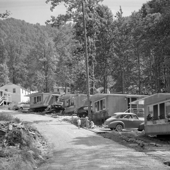
By the mid-1930s, ALCOA had assessed the Fontana Dam site and had purchased the property for construction. In 1935, the Tennessee Valley Authority (TVA) agreed with ALCOA to assume control of the Fontana project. Funding was difficult until the outbreak of World War II and the increased demand for power. Congress authorized TVA for funding of the project on December 17, 1941, just ten days after the attack on Pearl Harbor. Construction began in just a few weeks in January 1942 with 6,000 workers. The construction town of Fontana Village was created to house the project's workers. Fontana Village now exists as a tourist resort with some of the original structures still in use.
Fontana Dam was designed as a 480 foot high dam resulting in a 30 mile deep water lake, which would become Fontana Lake. The dam began producing power in 1945, even before construction was completed. Fontana is the tallest dam in the Eastern United States. At the time of its completion, it was the fourth tallest dam in the world. The reservoir, Fontana Lake, inundated the towns of the original Fontana, Bushnell, Forney, and Judson and necessitated the relocation of 1311 families, 1047 graves and over 60 miles of roads including sections of NC 288 (now NC 28).